Determine GPS waypoints
Determine GPS waypoints
Vote: (1 votes)
Program license: Free
Version: 1.14
Works under: Android
Vote:
Program license
(1 votes)
Free
Version
1.14
Works under:
Android
Pros
- Accurate GPS, accelerometer, and magnetic field readings.
- Support for both geocaching and location finding.
- Storage capacity for up to 500 waypoints.
- Supports both imperial and metric units.
- Allows import and export of waypoints.
Cons
- Requires users to maintain awareness of their surroundings.
GPS Waypoint Finder is a versatile, free-to-download navigation and travel app designed to calculate the distance and direction to a given GPS waypoint. With the help of various sensors like GPS, accelerometer, and magnetic field, it offers accurate readings without the need for level holding, distinguishing it from traditional compasses.
A Multitude of Tools at Your Disposal
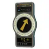
The GPS Waypoint Finder employs the accelerometer to align the magnetic field reading to the horizontal plane. It offers a plethora of information including the direction and distance to the waypoint, GPS reading, time, and a compass ring showing the current heading direction.
Notably, the app supports both geocaching and location finding, with a storage capacity for up to 500 waypoints. Additionally, it changes the color of the arrow as you approach the waypoint, providing a visual cue of your proximity to the target. The app accommodates both metric and imperial units, and facilitates the import and export of waypoints.
Alertness is Key
While GPS Waypoint Finder is a highly functional navigator capable of determining the distance and direction of GPS waypoints, users need to remain aware of their surroundings. The app offers numerous features such as compass direction, waypoint storage, and unit customization, making it a valuable asset for geocaching. However, safety is paramount, and users should ensure they remain attentive to their surroundings while using the app.
Pros
- Accurate GPS, accelerometer, and magnetic field readings.
- Support for both geocaching and location finding.
- Storage capacity for up to 500 waypoints.
- Supports both imperial and metric units.
- Allows import and export of waypoints.
Cons
- Requires users to maintain awareness of their surroundings.


